IMU Tilt Compensation
Free Yourself from Tedious Leveling Work
In field surveying, there is a operation that almost every surveyor knows all too well—leveling.
Find the survey point, set up the equipment, adjust the bubble, confirm the instrument is level, and collect the coordinates…
Move to another point, and repeat the process.
If a project requires dozens, hundreds, or even thousands of points to be surveyed, these seemingly simple steps are repeated over and over, taking up a considerable amount of time.
So, if you were responsible for collecting a large number of coordinate points for a surveying project, what might bring your work to a standstill?
Is it the countless survey points?
Rugged and uneven terrain?
Special points where leveling is difficult?
Or perhaps the tedious and repetitive process of leveling at every single point?
Of course, it could simply be this: you are tired of having to level the pole before measuring every point.
But what if you could measure accurately without leveling?
We have spoken with many surveyors and heard similar complaints:
“Why does the pole have to be kept vertical just to collect a coordinate?”
“It would be great if the instrument could automatically detect the tilt of the pole.”
“If I could get accurate coordinates without leveling every time, that would be amazing.”
In fact, this is exactly the problem IMU tilt compensation technology is designed to solve.
IMU tilt compensation technology can continuously detect the attitude and tilt of the survey pole and compensate for the measurement offset caused by its inclination.
In other words:
Before: Level first, then measure.
Now: Point at the target and measure directly.
This means that many repetitive leveling operations in conventional surveying can be significantly reduced.
G60 Pro: Making Difficult-to-Level Points Easy to Measure
To verify the performance of IMU tilt measurement in real field conditions, we used the Geodex G60 Pro to conduct tests in a variety of scenarios.
Instead of deliberately choosing flat and ideal environments, we went directly into real outdoor settings and selected several representative survey points:
Wall edges, under trees, slopes, riverbanks, stairs…

These points had one thing in common:
The survey point is easy to locate, but it is difficult to level the pole using conventional methods. In other words, you may need to hold the survey pole at an angle to accurately position the pole tip over the target point.
And this is exactly where IMU tilt compensation can make a difference.
Simply position the pole tip accurately over the target point. Even when the pole is tilted, the G60 Pro can use IMU attitude information to compensate for the tilt and complete coordinate collection.
No need to repeatedly move around to find a suitable standing position.
No need to constantly adjust the pole to keep it vertical.
And no need to spend a large amount of time leveling because of a difficult survey point.
Let the instrument adapt to the field environment, rather than forcing the surveyor to adapt to the instrument.
Up to 60° Effective Tilt Angle
Of course, IMU tilt compensation is not simply about “tilting the pole.”
For surveying instruments, the real question is:
Can the instrument still meet the accuracy requirements of engineering surveys when the pole is tilted?
The Geodex G60 Pro supports an effective IMU tilt measurement angle of up to 60°.
Even when the survey pole is significantly tilted, the device can still maintain the accuracy required for engineering applications with the IMU function enabled. The specifications are as follows:

This means that points that were difficult to level using conventional methods can now be measured with a more efficient approach.
One Calibration, Continuous Measurement
In addition to tilt measurement itself, the IMU workflow on the G60 Pro is also simple.
When enabling the IMU function, you only need to perform one IMU accuracy calibration.
After calibration, you can continue using IMU tilt measurement throughout subsequent measurements.
As long as the device remains in normal operation and the IMU accuracy meets the required standard, there is no need to recalibrate for every survey point.
The process can be simplified into three steps:
1. IMU Calibration
2. Point at the Survey Point
3. Collect Coordinates
You only need to recalibrate when the device is powered off and restarted, or when the system detects that the IMU accuracy no longer meets the required standard.
For field projects that require a large number of points to be collected continuously, this workflow can significantly reduce repetitive operations.
One Less Leveling Operation Means One Less Minute?
Let’s make a simple calculation.
Suppose conventional surveying takes an additional 1 minute on average to level the pole at each point.
Then:
10 points → about 10 minutes saved
60 points → about 1 hour saved
300 points → about 5 hours saved
In real engineering projects, surveyors often need to collect far more than a few dozen points per day.
More importantly, real field environments are not always ideal.
When working on slopes, stairs, wall corners, around obstacles, or other challenging locations, the time required for conventional leveling may increase even further.
Therefore, the more points you need to survey and the more complex the environment, the more noticeable the efficiency advantage of IMU tilt compensation becomes.
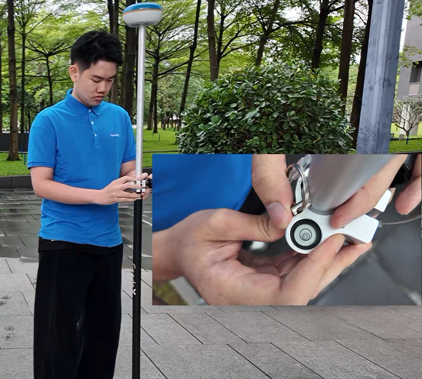
IMU OFF
The bubble must remain centered.
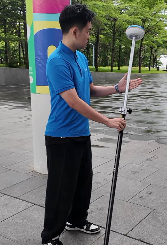
IMU ON!
As you want!
Not Just Better Efficiency—Fewer Potential Human Errors
Leveling is not only time-consuming. It is also a process that requires surveyors to continuously make manual adjustments and judgments.
Is the pole truly vertical?
Is the bubble centered?
Is the ground level enough?
Did the pole move slightly during measurement?
For conventional surveying methods, these details can potentially affect the final measurement results.
IMU (Inertial Measurement Unit) is the compact sensor equipped in the receiver, which is used to detect the movement and orientation of the survey pole. The IMU integrates data from an accelerometer, gyroscope, and, in some systems, a magnetometer. By processing these data through sophisticated algorithms, the system can estimate the pole’s tilt angle and determine the actual position of the pole tip.With the help of IMU technology, the need for manual leveling can be significantly reduced. Except when collecting points that require extremely high accuracy, such as control points and other high-precision survey points, IMU tilt-compensated measurement can be used directly, eliminating the need for leveling.
This means fewer repetitive operations and allows surveyors to focus more on the survey points and project tasks rather than constantly adjusting the instrument.
Reducing leveling does not mean sacrificing accuracy.
Instead, it uses technology to reduce unnecessary manual operations and make surveying simpler and more efficient.
From “Level Every Point” to “Point and Measure”
For a long time, leveling has been an essential part of surveying work.
It is important.
And it has played a key role in ensuring measurement quality in conventional surveying.
But being important does not mean every repetitive task must be performed manually.
The development of technology is essentially about continuously transferring repetitive, tedious, and time-consuming tasks from people to machines.
In the past, we had to spend time keeping the survey pole vertical.
Today, IMU technology can help the device detect the attitude of the pole and compensate for its tilt.
In the past, a difficult-to-level point could mean more time and more operations.
Today, you simply need to:
1. Point at the survey point.
2. Press the measurement button and get the coordinates.
This is the change that IMU tilt compensation technology brings to modern RTK surveying.
The world is changing every day, and surveying technology continues to evolve.
It is time to let technology replace repetitive manual operations.
Let the IMU tilt measurement function of the Geodex G60 Pro free you from tedious leveling work.
Less Leveling. More Measuring.
Stay Accurate, Work Efficiently.
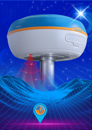
Geodex G60 Pro
Click the picture to get more details!