CORS Station GNSS Receiver
Send Inquiry Now
Fast response within 24 hours
Technical Specifications
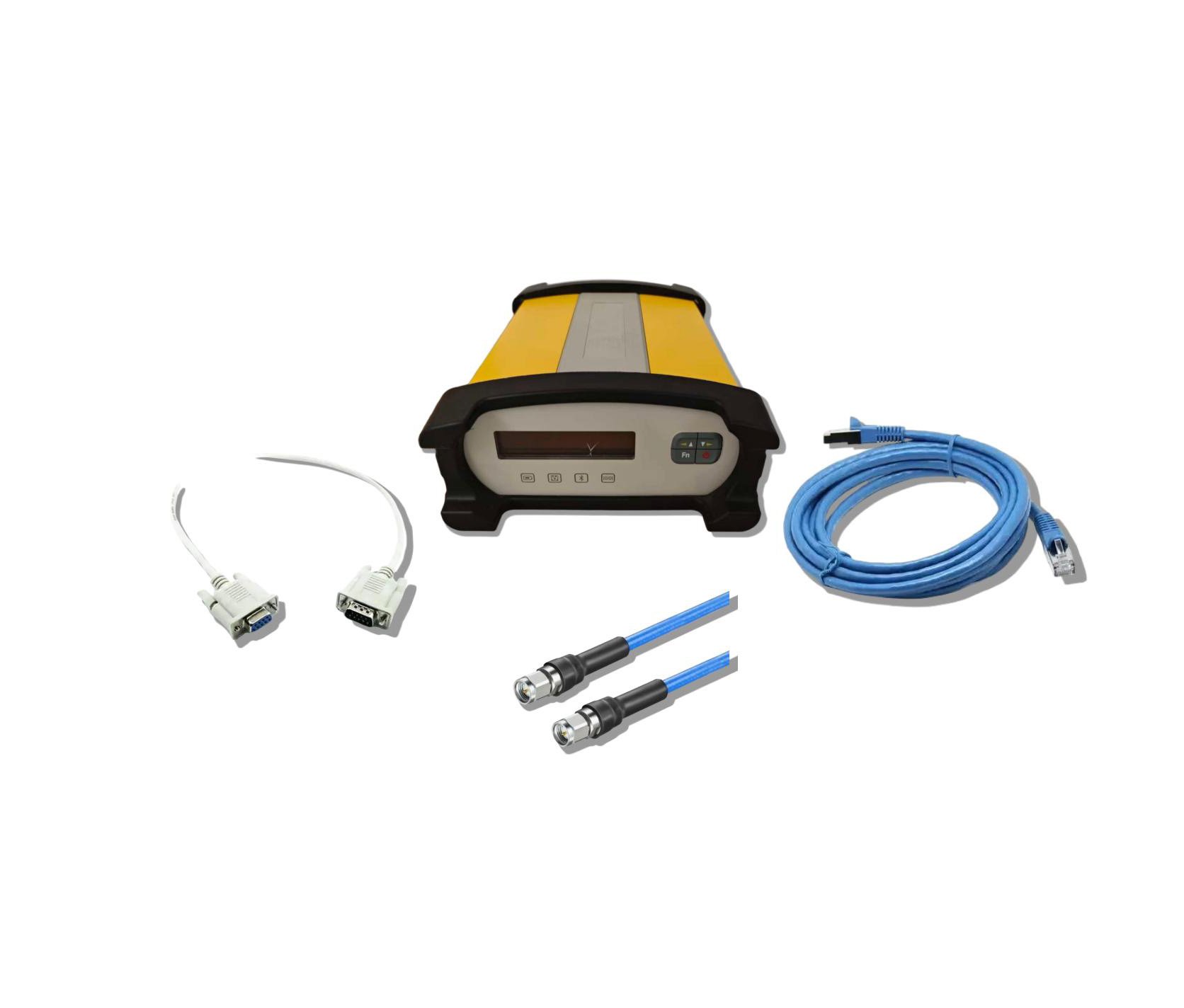
Standard Configuration
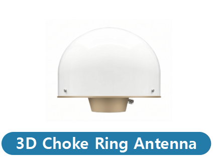
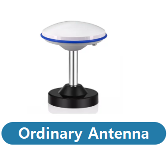
Optional Configuration
Networking Software
| GNSS | |
| Satellites Tracking |
GPS: L1C/A, L2P (Y), L2C, L5 BDS: B1I, B2I, B3I, B1C, B2a, B2b GLONASS: L1, L2 GALILEO: E1, E5a, E5b, E6 QZSS: L1, L2, L5, L6 SBAS: L1, L5 L-Band: B2b PPP (Only for the Asian-Pacific region) |
|---|---|
| Channels | 1408 |
| Signal Reacquisition | < 1 second |
| Cold Start | < 60 seconds |
| Warm Start | < 30 seconds |
| Hot Start | < 10 seconds |
| Initialization Reliability | > 99.9% |
| Update Rate | 20 Hz |
| Operation System | Linux + A8 |
| Internal Memory | 32G |
| Communication | |
| Bluetooth | BT5.0 + EDR, compatible with BLE |
| Wi-Fi | 802.11 b/g/n |
| Ethernet | Support |
| Port |
2-pin, DC in 7-pin USB OTG, host / client 5-pin RS232 5-pin RS232/RS485 DB9 female RS232 LTE SMA female 1 PPS SMA female Event SMA female SIM slot Micro SD card RJ45 Ethernet, 100/1000 Mbit, POE GNSS TNC female |
| Baud Rate | 4800-921600 |
| Web UI | Support |
| NMEA Output | NMEA0183, Binary, ASCII |
| Correction Data | RTCM V3.0, RTCM V3.3, RTCM2.3, CMR, DGPS, RAW |
| Recording Format | Binary, RINEX, BINEX |
| Recording Interval |
2s, 10s, 15s, 30s, 60s 1 Hz, 2 Hz, 5 Hz, 10 Hz, 20 Hz |
| Data Stream |
Bluetooth Serial port x 3 Ntrip sever stream x 4 Ntrip Caster stream x 1 Ntrip client stream x 1 Socket (TCP/UDP) stream x 5 |
| Smart Alert | E-mail, SMS |
| FTP Function | FTP server, FTP client (FTP push) |
| NTP Server | Support |
| Others | DDNS, SNMPD, Firewall, VPN |
| Performance | |
| Static Accuracy |
Horizontal: 3 mm + 0.5 ppm Vertical: 5 mm + 0.5 ppm |
| Real-time Kinematic Accuracy |
Horizontal: 8 mm + 1 ppm Vertical: 15 mm + 1 ppm |
| Physical | |
| Size | 222 mm × 164 mm × 81 mm |
| Weight | 1.95 kg |
| Input Voltage | DC 9-36 V (with reverse polarity protection) |
| Power Consumption | Typical 4.5 W |
| Operating Temperature | -45°C to +80°C |
| Storage Temperature | -55°C to +90°C |
| Humidity | 95% non-condensing |
| Waterproof / Dustproof | IP67 |
| Shock | Survive a 1-meter drop onto concrete |
RTK CORS Network Management & Positioning Software
The Geodex NRTK platform is an enterprise-grade solution engineered for high-precision GNSS network management and positioning. Powered by advanced optimization algorithms, it intelligently links multiple reference stations to establish a robust, long-baseline CORS infrastructure.
By breaking through traditional distance limitations, the system delivers uninterrupted, real-time correction data. This ensures field operators across the entire coverage area consistently achieve reliable, centimeter-level accuracy for their most critical operations.
Download NRTK Brochure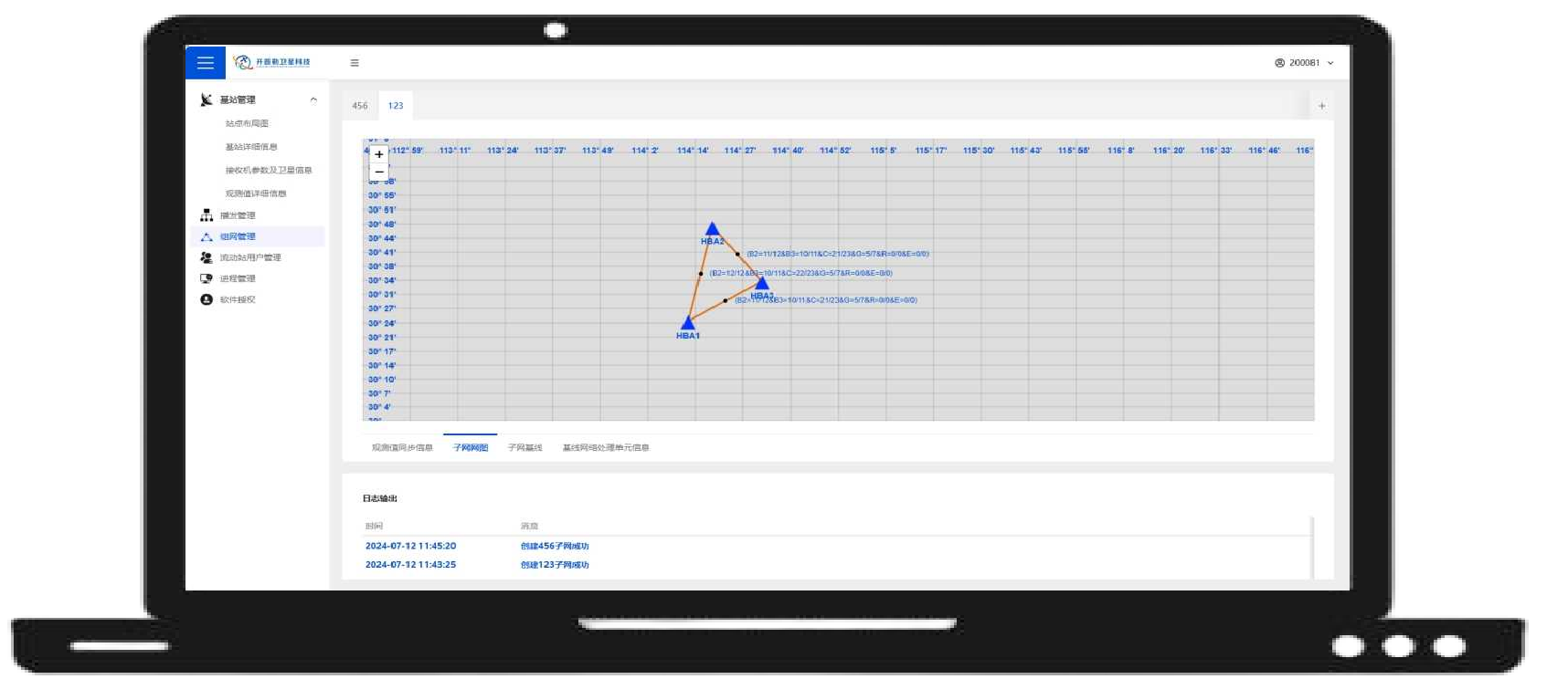
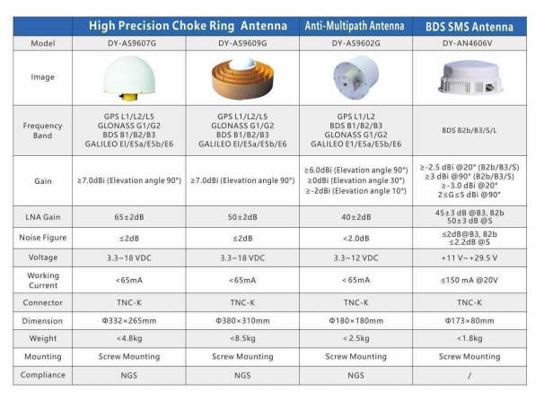
High Precison Choke Antenna & Anti-Multipath Antenna

Get in touch
Click the button to reach out, fast response within 24 hours!