4 Common Methods for Measuring RTK Antenna Height
2026-9-14
In both static GNSS surveying and real-time kinematic (RTK) operations, accurately determining the antenna height is critical to obtaining reliable coordinate and elevation data. Antenna height refers to the vertical distance from the antenna's Phase Center (APC) to the ground control point.
Depending on your field setup and equipment accessories, four primary methods are used to measure antenna height: Pole Height, Slant Height, Direct Height, and Measuring Plate Height. Below is a detailed breakdown of each technique.
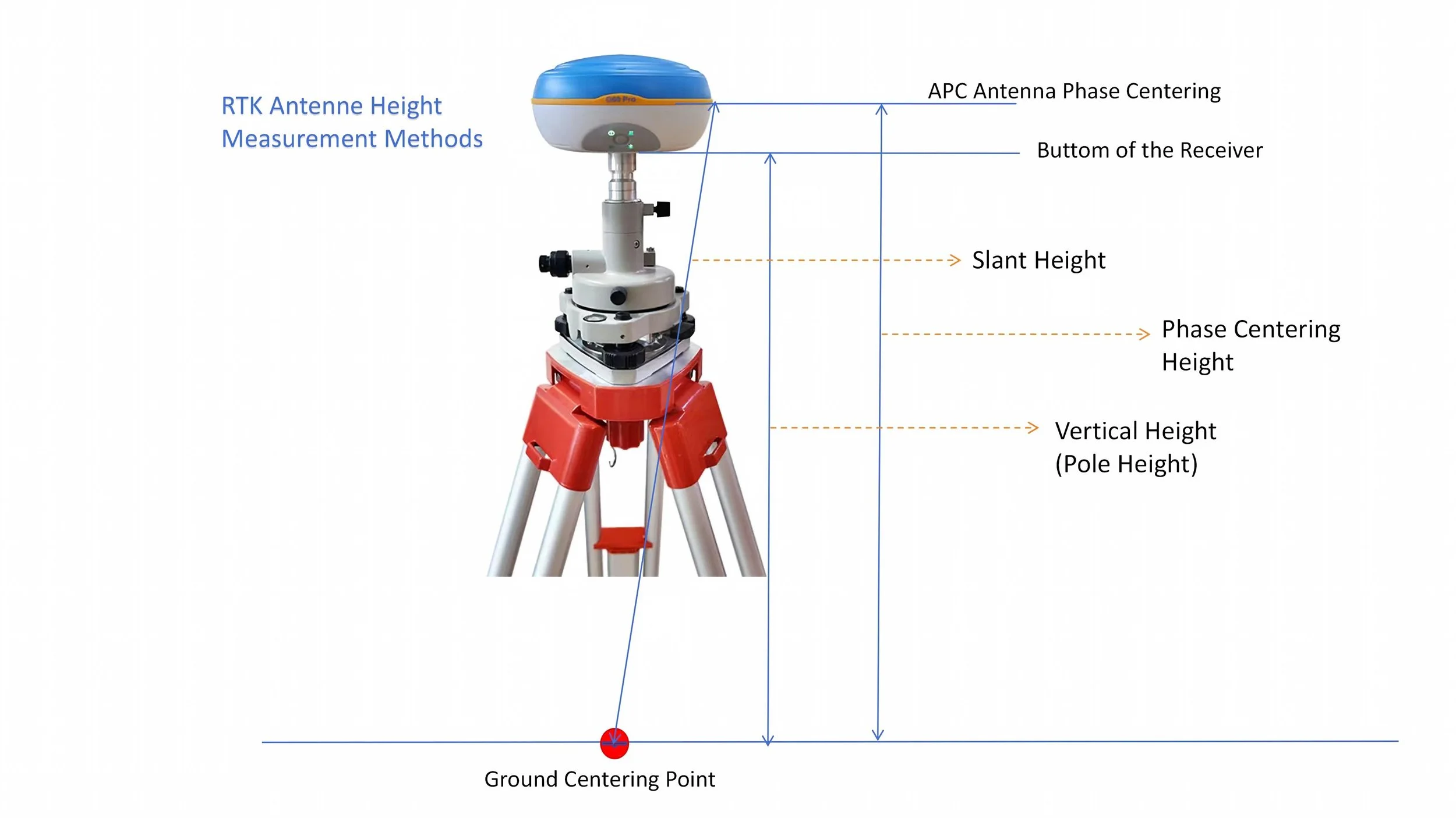
RTK Antenna Height & Static GNSS Antenna Height
4 Common Measurement Methods
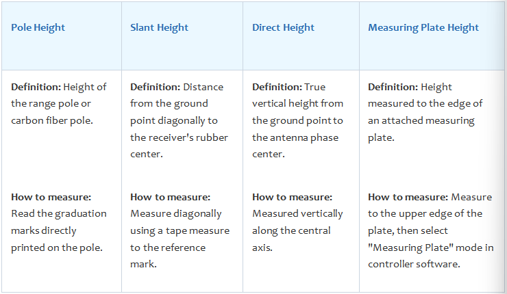
RTK Antenna Height & Static GNSS Antenna Height
Key Considerations for Field Operation
To ensure high accuracy and prevent systematic errors during fieldwork, keep the following guidelines in mind:
● Proper Plate Orientation: When using a height-measuring plate, ensure the convex (raised) side faces upward. Measurements must be taken precisely to the raised edge of the plate.
● Multiple Measurements: Always measure the height multiple times and compute the average value to minimize human measurement errors.
● Software Selection: Ensure the antenna height mode selected in your field controller software (e.g., Slant, Vertical/Direct, or Height Plate) strictly matches the physical measurement method used in the field.
Conclusion
Selecting the correct antenna height measurement method and entering the corresponding parameters in your controller is essential for millimeter-level GNSS accuracy. For more technical guides and high-precision GNSS hardware solutions, visit Geodex Tech