
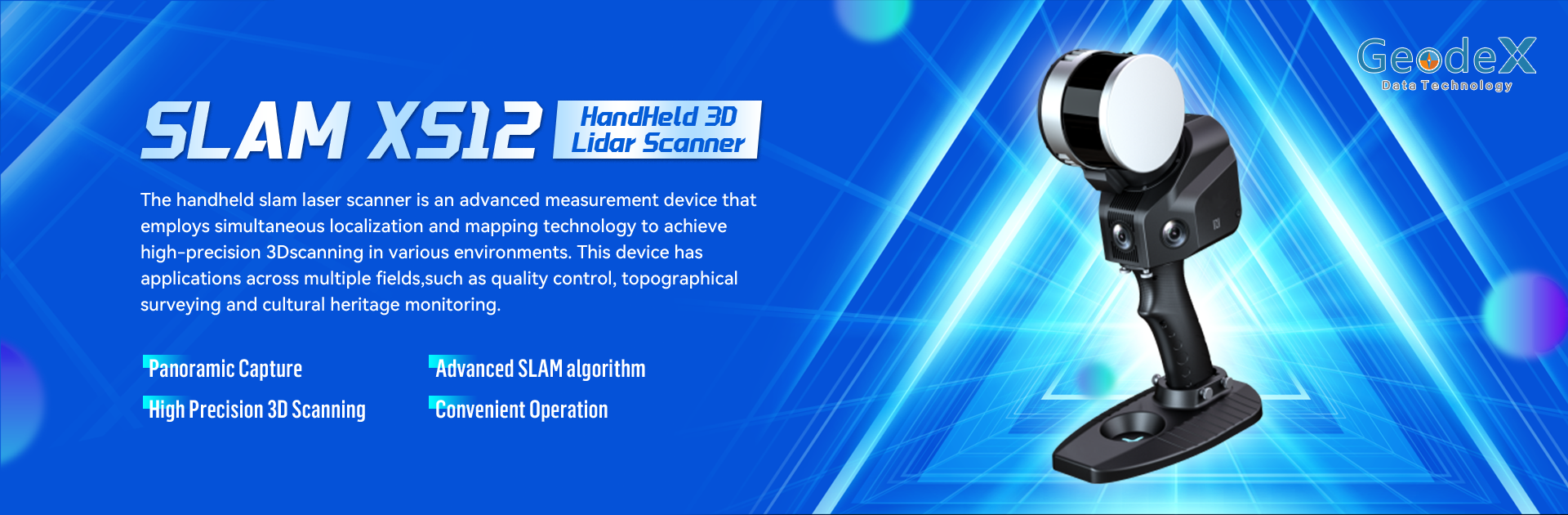
Brief Introduction
SLAM XS12 is an advanced handheld mobile laser scanner equipped with industry-leading SLAM algorithms, enabling high-precision 3D data acquisition without the need for GPS or external lighting. Integrating laser scanning, a 360°rotating laser scan head, and real-time data processing, SLAM XS12 quickly generates centimeter-level accurate 3D point cloud and color image data.
Panoramic Capture
High Precision 3D Scanning
Advanced SLAM Algorithm
Convenient Operation


Main Features
Laser Scanning System
Field of View: 270° × 360° dynamic scanning coverage
Range Capability: Up to 120m (Class 1 laser safety)
Accuracy Performance: 2cm relative accuracy
5cm absolute accuracy
Scanning Frequency: 320kHz pulse repetition rate
Supports operation in no-light and GPS-denied environments, utilizing a dynamic rotating scanning mode for full spatial data coverage.
Visible Light Camera
Vision Module: Three 5MP cameras (200° horizontal × 100° vertical).
Synchronized Capture: Supports RGB texture mapping and panoramic image stitching.
.
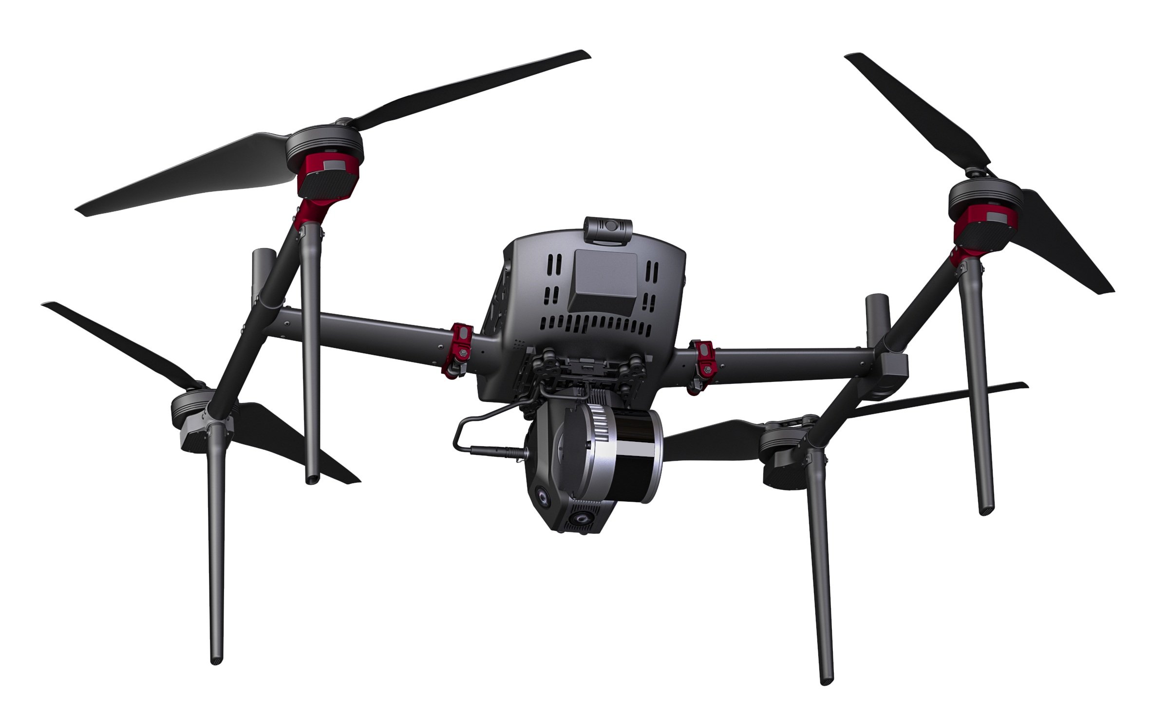
Versatile External Interfaces
Supports USB, SD card, NFC, and peripherals like panoramic cameras and GNSS modules.
Compatible with drones, vehicles, and the S-PACK100 backpack for mobile scanning.
Efficient Operation Mode
Protection Design: IP54 dustproof and waterproof rating, adaptable to extreme environments from -10℃ to 45℃.
Battery Life: Equipped with four replaceable 3350mAh lithium batteries, providing up to 2.5 hours of continuous operation.


Intelligent Data Processing
SLAM GO APP enables cloud-based project management, real-time point cloud preview, and device firmware updates.
SLAM GO POST software supports point cloud rendering, volume measurement, panoramic image generation, and other post-processing functions.


Wider Measurement Range
Powerful laser scanning capability supports larger-scale data acquisition.
High-Precision Modeling
Utilizes industrial-grade SLAM algorithms and is compatible with the S-RTK100 module, achieving centimeter-level surveying accuracy.
Real-Time 3D Modeling
Enables simultaneous walking and surveying, quickly generating 3D models and improving data processing efficiency.
Fast Data Processing
Built-in high-performance computing unit enables real-time data processing and storage.
Compact and Lightweight
Small and portable design allows for single-person operation, enhancing fieldwork efficiency.
Advantages & Benefits

Engineering Surveying
Main Applications


Emergency Response


Digital Twin Technology
Cultural Heritage Preservation