

Core Features
Calibration-Free IMU
Built-in high-precision MEMS gyro & accelerometer deliver instant precise tilt compensation. Simply aim the pole to survey points, with no strict leveling or repeated magnetic calibration.
High-Frequency Data Capture
It features a 20Hz high data refresh rate and 8GB internal storage. It supports bulk continuous point capture and full-format differential data logging, enabling all-day field data recording without external storage.
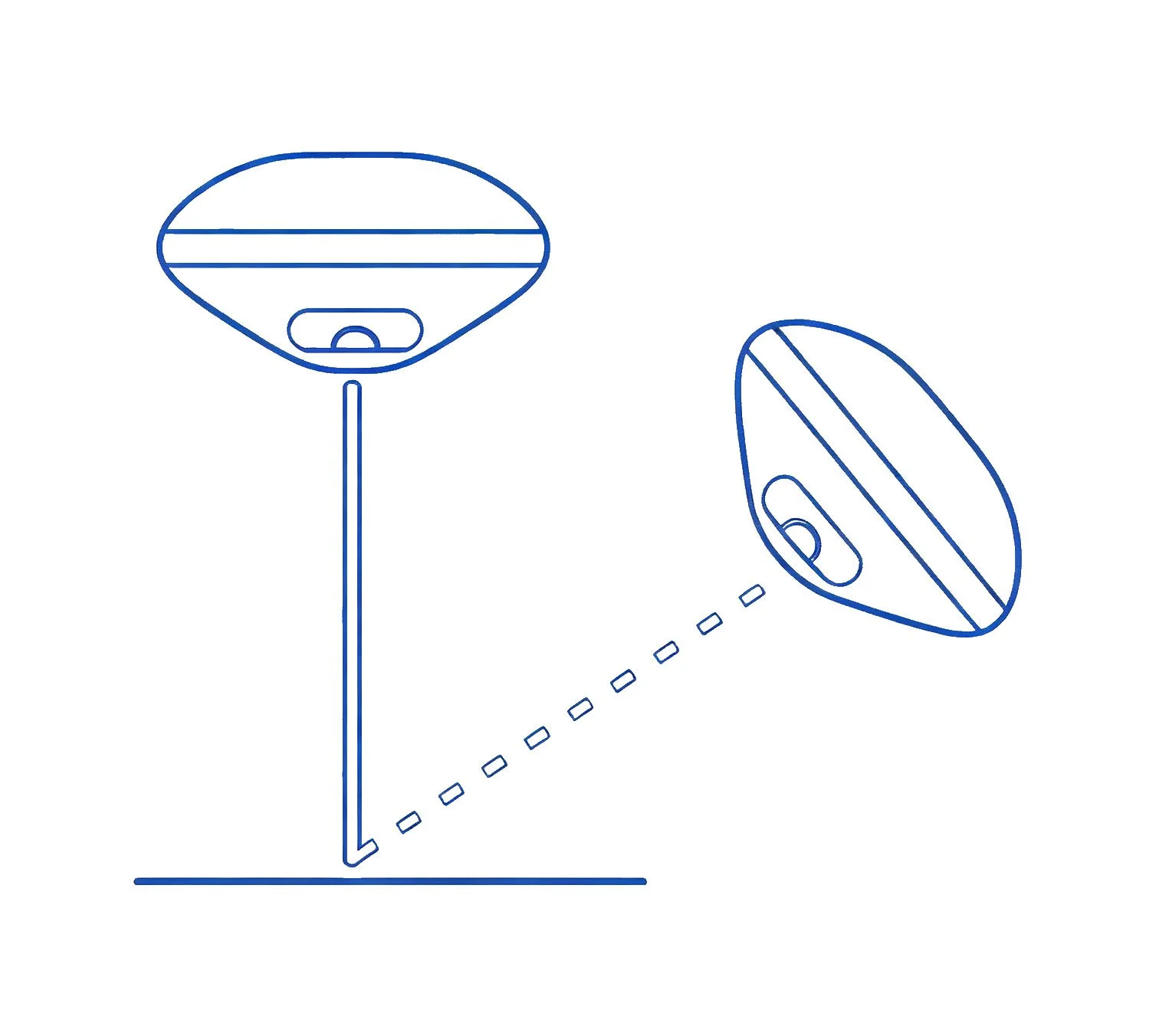
Immersive Visual Survey with Dual Camera
Equipped with dual 2MP global shutter cameras featuring a 75° Field of View (FOV) and 30 fps smooth video tracking. The bottom camera enables seamless, real-time AR stakeout, overlaying design points directly onto your screen to eliminate guesswork and guide you straight to the target.

Key Advantages

Dual-Camera Visual Survey & Stakeout
Adopts dual visual cameras for real-time 3D scene reconstruction, enabling fast, intuitive surveying and construction stakeout without extra accessories.

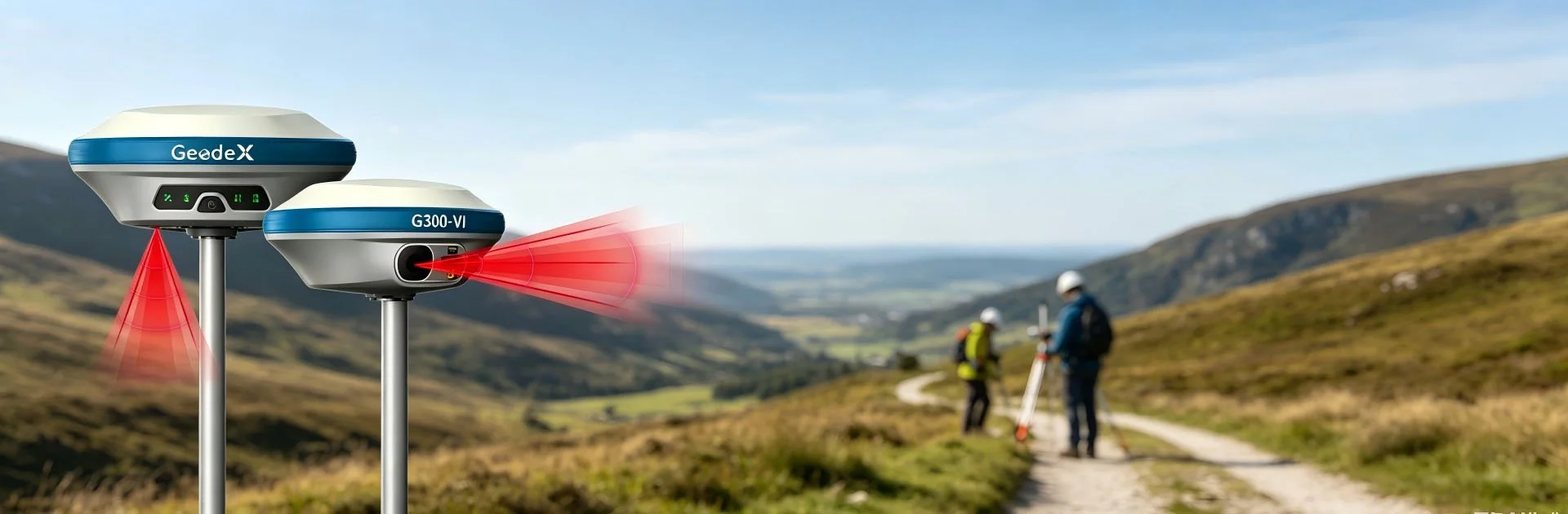
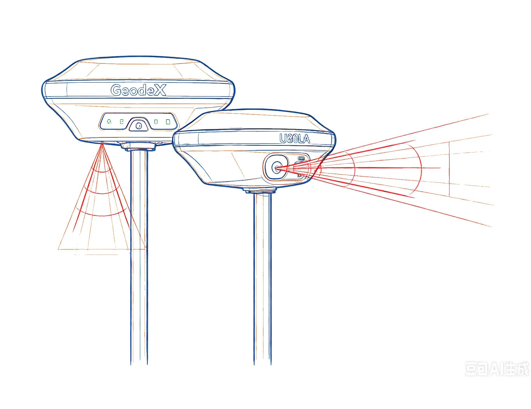
Laser-Assisted High-Precision RTK
Integrates laser ranging with RTK positioning to deliver centimeter-level accurate measurement, eliminating positioning deviation in complex site environments.

Full GNSS with 1408 Channels
Supports full global satellite constellations via 1408 signal channels, achieving stronger signal lock, faster fix and stable positioning under tree canopies or urban obstructions.
Main Applications

Urban & Cadastral Surveying
Maintain strong fixed solutions in high-multipath environments like city streets and residential areas.
Inaccessible Point Mapping
Use laser and IMU integration to measure building corners, deep trenches, or points across busy highways.

Visual & AR Stakeout
Drastically reduce stakeout time in complex construction sites using visual guidance.
Product Video

Get in touch.
Click the button to reach out, fast response within 24 hours!

scan to add wechat